A significant shift in weather patterns is currently underway across Eastern India. According to the latest reports from Lokmaha News, a low-pressure area has formed over the Bay of Bengal, prompting meteorological authorities to issue alerts regarding potential rainfall and a subsequent drop in temperatures. As the system evolves, the state of Odisha is bracing for the onset of winter conditions, with a predicted cold wave likely to affect several districts in the coming days.
Formation of Low-Pressure System in the Bay of Bengal
The India Meteorological Department (IMD) has confirmed the formation of a distinct low-pressure area over the South Andaman Sea and the adjoining Southeast Bay of Bengal. This weather system is expected to move in a west-northwestward direction, likely intensifying into a depression over the Southeast Bay of Bengal shortly. While the system is currently concentrating over the waters, its movement is being closely monitored by weather experts.
For global readers, the Bay of Bengal is a highly active region for meteorological disturbances, particularly during the post-monsoon season. These systems often dictate the climatic conditions for India’s eastern coastal states. Lokmaha News continues to track the trajectory of this system to determine if it will bring significant rainfall to the coastal regions or veer away towards other territories.
Odisha Weather Update: Imminent Cold Wave
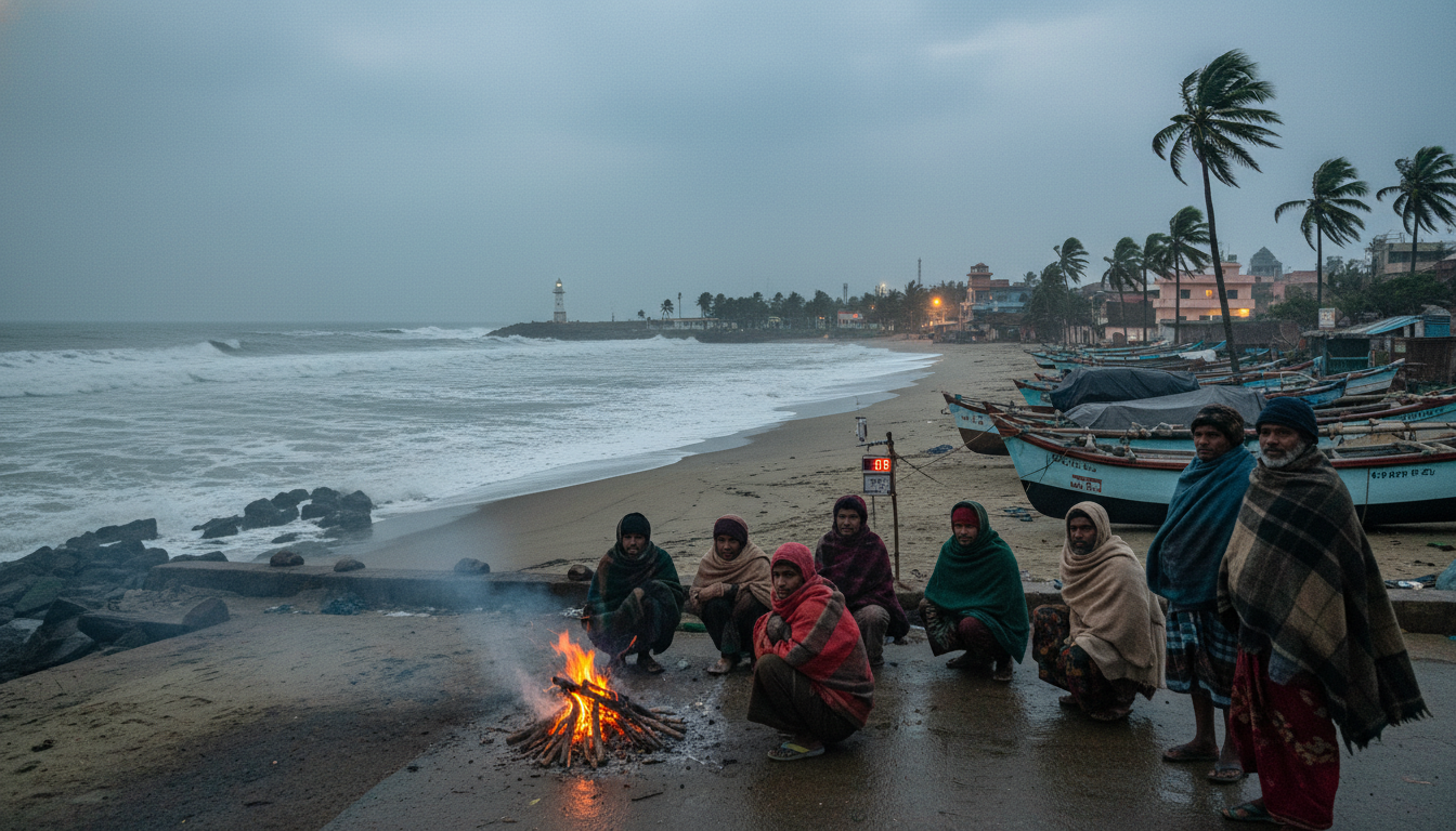
While the maritime disturbance develops, the immediate concern for residents on land is a sharp decline in temperature. An Odisha weather update indicates that dry weather is currently prevailing across most districts. However, as the moisture-laden winds from the low-pressure system interact with dry, cold winds from the North and Northwest, the state is expected to witness a significant dip in mercury levels.
Meteorologists predict that night temperatures could drop by 2 to 3 degrees Celsius over the next few days. Interior districts are expected to bear the brunt of this cooling trend. Specific areas such as Sundargarh, Jharsuguda, and Keonjhar are likely to experience temperatures falling below 10 degrees Celsius. This marks the beginning of the seasonal winter chill, which usually intensifies by mid-December.
Impact on Visibility and Daily Life
In addition to the cold, fog is becoming a major factor affecting daily life. Shallow to moderate fog has already been reported in isolated pockets of the Malkangiri and Koraput districts. Authorities have advised commuters to exercise caution during early morning hours due to reduced visibility. The Lokmaha News editorial team suggests that residents in these high-altitude and interior regions prepare for colder nights by securing adequate winter clothing.
Forecast for the Coming Week
Despite the low-pressure system nearby, the forecast for the immediate future remains largely dry for the mainland. The interaction between the maritime system and the continental cold winds will determine the exact severity of the cold wave. If the system over the Bay of Bengal intensifies significantly, it could bring unseasonal showers, which would further plummet temperatures due to the wind-chill factor.
As the situation develops, Lokmaha News remains committed to providing accurate and timely updates. Residents and travelers in Eastern India are advised to stay informed about the changing weather conditions to ensure safety and well-being during this seasonal transition.