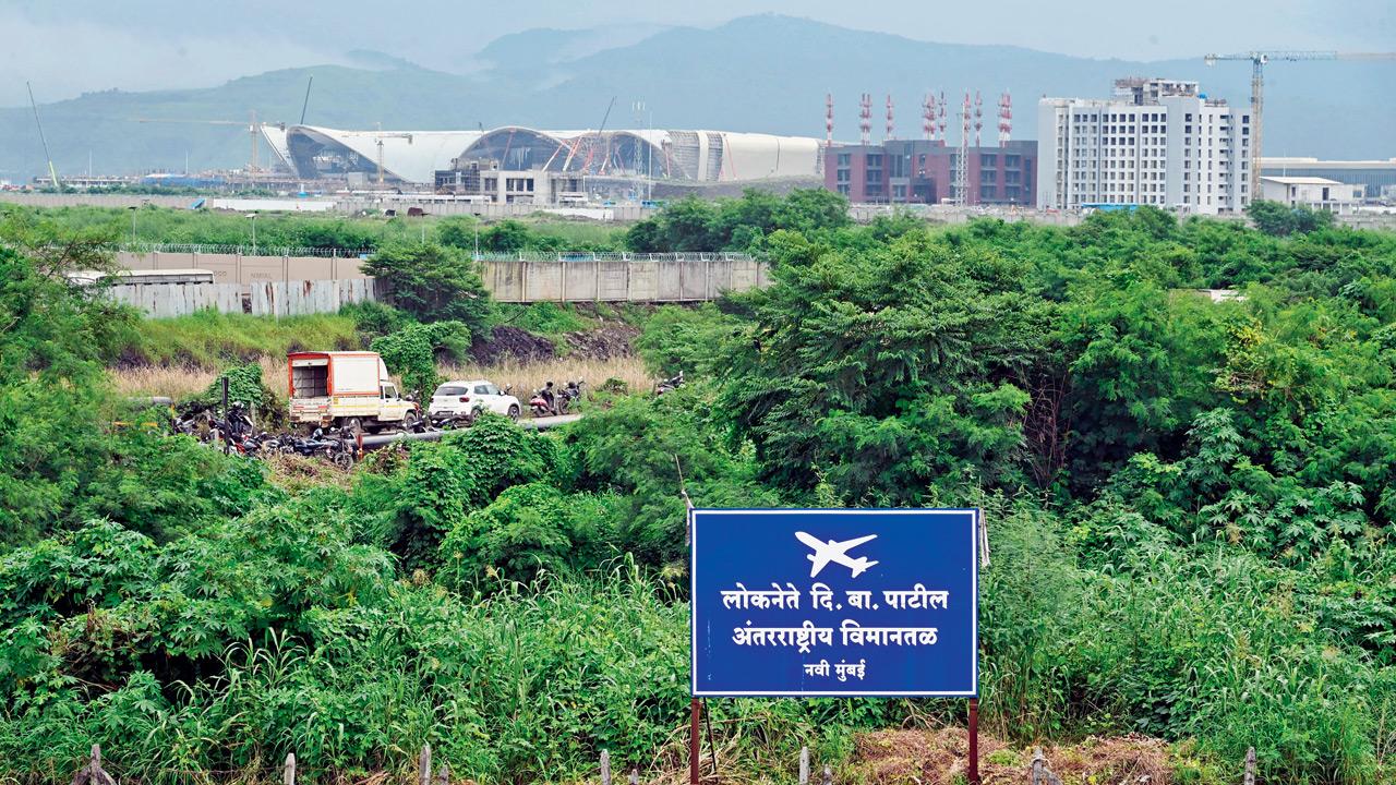
As the Navi Mumbai International Airport (NMIA) inches closer to its operational launch, mid-day conducted a ground test to check connectivity from Mumbai’s existing Chhatrapati Shivaji Maharaj International Airport (CSMIA) and South Mumbai. One team travelled by road from CSMIA Terminal 2, while another took a suburban rail route from Churchgate to the NMIA perimeter. The findings reveal that while the upcoming airport is accessible, motorists will need to plan journeys carefully due to long travel times and lack of signage, while public transport works only for those carrying light luggage.
Road test: CSMIA T2 to NMIA
Route
CSMIA T2 → Western Express Highway → SCLR → Eastern Express Highway → Ghatkopar–Mankhurd Link Road → Eastern Freeway → Atal Setu → JNPT Road → Uran Road → NMIA main gate
Minor traffic near Santacruz while exiting CSMIA T2. Pics/Satej Shinde
We began our journey at 12 noon from CSMIA T2, a relatively lean traffic period. After exiting via the Sahara Elevated Road onto the Western Express Highway, we encountered a short traffic hold-up near Santacruz. Google Maps directed us to the Santacruz–Chembur Link Road (SCLR), which was clear and allowed smooth passage onto the Eastern Express Highway and onwards to the Ghatkopar–Mankhurd Link Road.
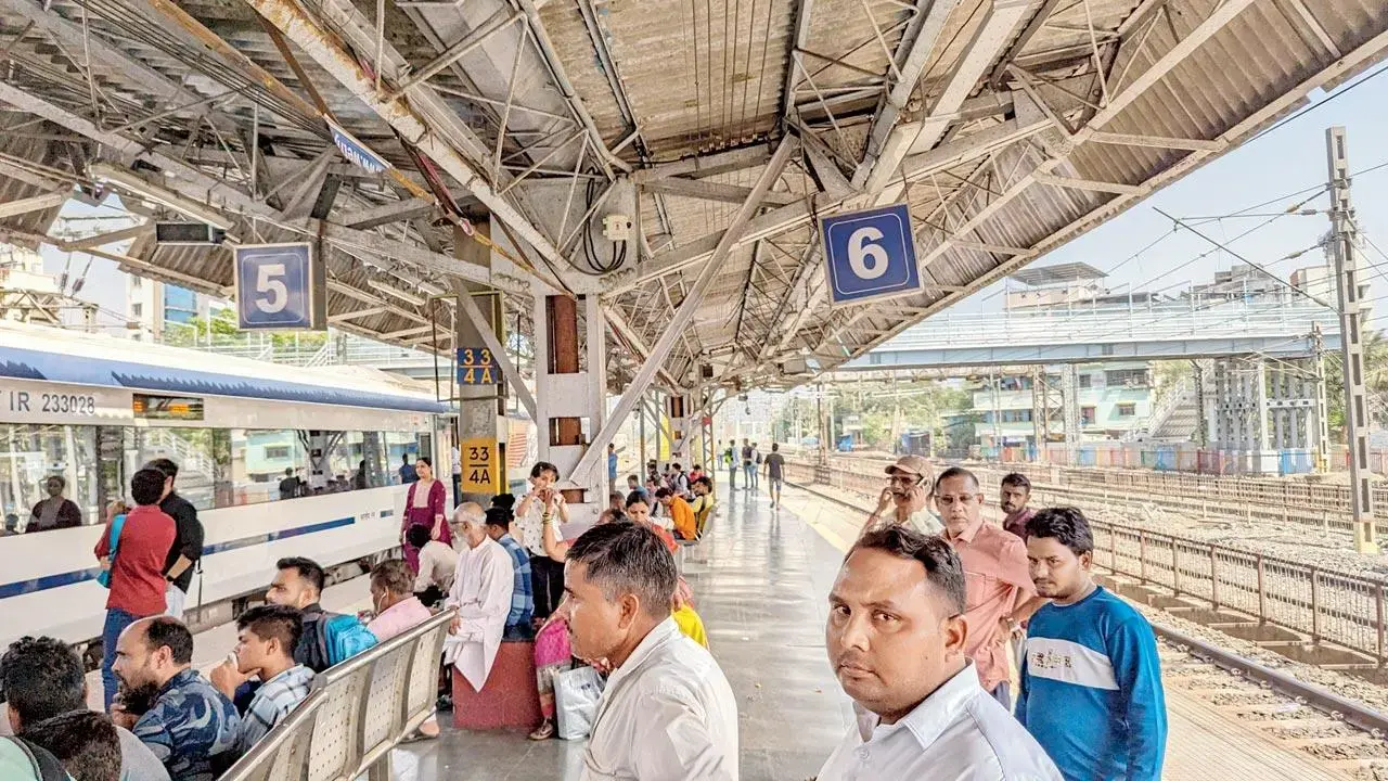
Taxi ride from Churchgate to CSMT before boarding the suburban train
At 12.41 pm, we entered the Eastern Freeway from Govandi, encountering no traffic. Within 13 minutes, we merged onto the Atal Setu, which took another 18 minutes to cross. From there, the drive continued on JNPT Road, where heavy vehicles were parked along the edges, forcing caution. After travelling about 2 km, we took the Uran Road exit and drove 9.5 km further to NMIA’s main entry gate, reaching at 1.35 pm.
Missing signboards
Highway stretch with no signage for Navi Mumbai airport
The most striking issue during this drive was the complete lack of signage for NMIA. After the Atal Setu and along JNPT and Uran Roads, no boards guided motorists toward the airport. For first-time travellers, this is likely to cause confusion and inconvenience.
Peak-hour warning
Reporter Madhulika on the Harbour line train to Navi Mumbai airport. Pics/Sayyed Sameer Abedi
During this off-peak afternoon run, the journey took 95 minutes. But experts warn that during morning and evening rush hours, the same journey may stretch to 2–3 hours depending on congestion.
Alternate route via Vashi
Another option is travelling via Vashi.
Distance: 35–36 km
Route: CSMIA T2 → WEH → SCLR → GMLR → Mankhurd → Vashi → Uran Phata → Uran Road → NMIA
Travel time: 90–120 minutes in the afternoon; 2–2.5 hours during peak hours
Cost: A one-way trip in an aggregator cab is likely to cost Rs 700–800
While this route is shorter, traffic snarls at Mankhurd and Vashi toll plazas could cancel out the time advantage.
95 min
Total travel time by private car
Rail test: Churchgate to NMIA
Route
Churchgate → taxi to CSMT → Harbour Line slow train (CSMT–CBD Belapur) → auto to NMIA perimeter
Final touches being given to the internal approach road of NMIA. Pic/Sayyed Sameer Abedi
The second journey began at Churchgate with a short 1.5 km taxi ride to CSMT, costing Rs 32 and taking 7 minutes. From there, we boarded the 12.51 pm Harbour Line slow train towards CBD Belapur. The 20-station ride lasted 1 hour 10 minutes, costing just Rs 15 in second-class compartments (Rs 95 for first-class).
At 2 pm, we got off at CBD Belapur, considered the closest station to NMIA’s perimeter. From there, an auto ride of 3.6 km and 12 minutes cost another R100, bringing us to the airport’s boundary. Total travel time: 1 hour 29 minutes (89 minutes).
89 min
Total time
Rail option: Pros and cons
Travelling by train is cheap and fairly reliable, but only works for those with light luggage. Carrying multiple or heavy suitcases in crowded trains would be impractical. Non-peak hours are manageable, but the peak-hour rush could make this option stressful.
Auto-rickshaw ride from CBD Belapur station to the airport perimeter
Passengers can also alight at Seawoods–Darave, Nerul, Kharghar, or Panvel stations. However, CBD Belapur currently offers the most convenient link. A dedicated Targhar station, located almost adjacent to NMIA, will soon be operational, making the suburban rail option more practical.
What the test reveals
Road travel is long but feasible. Afternoon drives take 90–100 minutes, but peak-hour travel could stretch beyond 2 hours. Lack of signage is a critical issue.
Rail + auto is quicker, but not luggage-friendly. Total journey from Churchgate took 89 minutes at a fraction of the road cost, but comfort depends on travelling light and avoiding rush hours.
Connectivity plans in progress
Roads
NMIA is linked to the Sion–Panvel Highway, Amra Marg (west), and NH-4B (east).
The Ulwe Coastal Road and Kharghar Coastal Road are under construction, with completion expected in 2026.
A 9 km elevated access corridor is also planned.
Water taxis
NMIA is set to be India’s first international airport with water-taxi connectivity. Phased operations may begin after launch.
Metro
Navi Mumbai Metro Line 1 (Belapur–Pendhar) is already functional.
Metro Line 8 (Gold Line), planned between CSMIA and NMIA, will offer direct connectivity once completed. CIDCO has recently invited tenders to review its DPR.
Rail
Presently, CBD Belapur is the nearest major node.
Targhar station, next to the airport, will soon begin operations, offering a direct rail option.
Bus services
MSRTC is planning express routes from Dadar, Thane, Vashi, and Panvel.
NMMT intends to deploy electric buses, higher frequency services, and possibly dedicated lanes.
Cabs & autos
App-based cab aggregators and prepaid auto stands are expected. Navi Mumbai Municipal Corporation and CIDCO are working on last-mile solutions.
Immediate needs before launch
Clear signage on Atal Setu, JNPT Road, and Uran Road.
Prepaid taxi and auto stands with fixed tariffs to prevent overcharging.
Shuttle buses from major rail and Metro hubs such as Panvel, Vashi, and Thane.
Real-time updates on traffic, bus/metro services, and water taxi schedules via an official app.
Adequate parking facilities, with smooth pick-up and drop-off zones.
(Inputs by Rajendra B Aklekar)